
Oklahoma Word Cloud
Word Cloud > Oklahoma
Oklahoma Information
Oklahoma was formed in 1907 after land runs provided settlers with claims. But, drought set in during the 1930s, and dust storms and lack of work sent many Okies fleeing. Today, cattle and wheat farming have recovered, and oil and gas wells have sprung up throughout the state. Some tallgrass prairie areas still exist and bison still graze on those areas. The Red River forms the state's southern boundary, while High Plains are found in the panhandle area.Authored by jeh. Last updated 2015-10-06 07:50:48.
- Oklahoma Map
Oklahoma is the 19th largest state in the USA, bounded by Kansas, Texas, Arkansas, New Mexico, Missouri, and Colorado. Visit this site to learn more about the State of Oklahoma and find printable maps of Oklahoma.
www.state-maps.org/oklahoma-map/ - Oklahoma Directory
Learn about Oklahoma's demographics and economy, and use the Categories Menu to find businesses and other organizations in Oklahoma.
www.regionaldirectory.us/oklahoma.htm - Oklahoma Real Estate Guide
Learn about urban, rural, and suburban real estate markets in Oklahoma. Real estate agents, buyers, and sellers will appreciate the Oklahoma real estate resources on this page.
www.local-real-estate.com/oklahoma.htm - Oklahoma Atlas
Oklahoma state history, geography, and travel information are the subjects of this Oklahoma atlas page.
www.onlineatlas.us/ok.htm - Oklahoma City Skyline (Photograph)
Captioned gallery photo and description of the Oklahoma City skyline, with a puffy cumulus cloud overhead.
www.onlineatlas.us/gallery/oklahoma-city.htm  Oklahoma Road Map (Illustration)
This Oklahoma map page includes a detailed, scalable road map of Oklahoma, as well as Interstate highway enumerations, scenic road highlights, and state road and transport links.
www.state-maps.org/oklahoma-map/road-map.htm- Missouri Map
Missouri is the 18th largest USA state, bordered by Iowa, Arkansas, Kentucky, Kansas, Illinois, Tennessee, Nebraska, and Oklahoma. Visit this site to learn more about Missouri and find printable maps of the state.
www.state-maps.org/missouri-map/ - New Mexico Map
New Mexico is the fifth largest state in the USA, bordered by Colorado to the north, Mexico to the south, Arizona to the west, and Oklahoma and Texas to the east.
www.state-maps.org/new-mexico-map/ - Texas Map
Texas is the 2nd largest state in the US. It is bordered by Oklahoma, Louisiana, Arkansas, New Mexico, the country of Mexico, and the Gulf of Mexico.
www.state-maps.org/texas-map/ - Pinterest - Oklahoma Board
This gallery page features selected Oklahoma images, including the state flag, a locator map, and various travel photos.
www.pinterest.com/onlineatlas/oklahoma/
Oklahoma Directory Page(s)
- Oklahoma Page on AbiReal.com
Visit this oklahoma category page on abireal.com to find editorially-reviewed resources about this topic.
http://www.abireal.com/info/914/oklahoma-map.html
- Oklahoma Page on Adirectory.us
Visit this oklahoma category page on adirectory.us to find editorially-reviewed resources about this topic.
https://www.adirectory.us/us-states/oklahoma/
- Oklahoma Page on GoGuides.org
Visit this oklahoma category page on goguides.org to find editorially-reviewed resources about this topic.
http://www.goguides.org/topic/1613.html
- Oklahoma Page on Jumblex.org
Visit this oklahoma category page on jumblex.org to find editorially-reviewed resources about this topic.
http://en.jumblex.org/oklahoma/
Oklahoma News
- Gavin Adcock takes aim at Zach Bryan in brutal call-out
Gavin Adcock shares a photo from his near-altercation with Zach Bryan at an Oklahoma festival, using it to promote his upcoming single release Friday.
Fox News. Wed, 29 Apr 2026 11:11:58 -0400. - Oklahoma sheriff's greedy spending spree laid bare as top cop RESIGNS to dodge jail time
An Oklahoma sheriff was accused of embezzling campaign funds and taxpayer money and using the cash on 40 new bought and leased vehicles, lavish meals, games, DoorDash service and a hotel room.
Daily Mail. Wed, 29 Apr 2026 12:04:46 GMT. - Storm chasers capture twin tornadoes as severe weather moves through central U.S.
Severe storms are moving through the Midwest on Monday after parts of Texas, Arkansas and Oklahoma saw tornadoes over the weekend. Rob Marciano has a look at the forecast.
CBS News. Mon, 27 Apr 2026 19:56:02 -0400. - WATCH: Tornado rips through northwest Oklahoma amid severe storms across Plains
More than a dozen tornadoes were reported across the central U.S. on Thursday night, including a powerful storm in northwestern Oklahoma.
ABC News. Fri, 24 Apr 2026 06:35:04 -0400.
Oklahoma Image
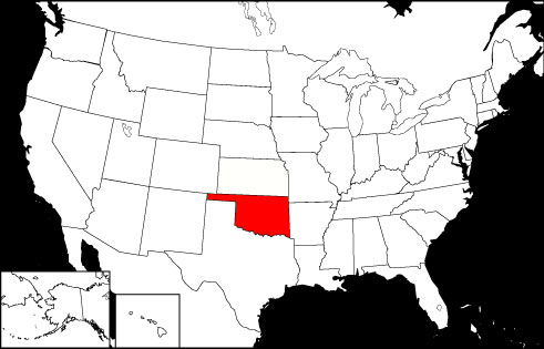 Oklahoma Locator Map
Copyright © 2012-2026 Word-Cloud.org. All rights reserved.