
Mexico Word Cloud
Word Cloud > Mexico
Mexico Information
Mexico is the third largest country in North America, and its inhabitants account for about 21.25 percent of North America's population. Mexico's population density is about 158 persons per square mile. Mexico is actually the most populous Spanish-speaking country in the world; it is located to the south of the United States and to the north and west of other Latin American countries in Central America and South America.Authored by seh. Last updated 2014-10-27 18:21:46.
- Mexico World Bank Data
World Bank statistical data and graphs about economic and social development patterns in Mexico. Data includes topics such as GNI per capita, school enrollment, and life expectancy.
data.worldbank.org/country/mexico - Mexico City Map
This Mexico City address locator map can help you find points of interest in Mexico City. You will also find information and maps of Mexico.
www.map-of-mexico.org/mexico-city.htm - Mexico Locator Map
Mexico is a country of rich history and old world charm. Much of Mexico's culture is a unique blend of Spanish and indigenous peoples, and Mexico is renowned for its food, architecture, and handicrafts.
www.map-of-mexico.org/mexico.htm - New Mexico Map
New Mexico is the fifth largest state in the USA, bordered by Colorado to the north, Mexico to the south, Arizona to the west, and Oklahoma and Texas to the east.
www.state-maps.org/new-mexico-map/ - New Mexico Real Estate Guide
Learn about urban, suburban, and rural real estate markets in New Mexico. Real estate agents, buyers, and sellers will appreciate the New Mexico real estate resources on this page.
www.local-real-estate.com/new-mexico.htm - New Mexico Atlas
New Mexico state history, geography, and travel information are the subjects of this New Mexico atlas page.
www.onlineatlas.us/nm.htm  New Mexico Road Map (Illustration)
This New Mexico map page features a detailed, scalable road map of New Mexico, as well as Interstate highway routes, scenic byway information, and transportation department links.
www.state-maps.org/new-mexico-map/road-map.htm- Albuquerque, New Mexico (Photograph)
Online gallery picture, with caption and description, of Albuquerque, New Mexico, with Mount Sandia shown in the background.
www.onlineatlas.us/gallery/albuquerque.htm - Mexico Flag (Digital Video)
On a black background, the flag of Mexico flutters gently in the breeze.
vimeo.com/68737009 - Mexican Flag
This website contains Mexican flag illustrations and photographs as well as reference information about the national flag of Mexico.
www.mexican-flag.org/ 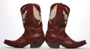 Vintage Western Boots (Photograph)
A pair of vintage western boots is photographed on a white background. The antique boots, which are dark brown, are positioned so that the heels of the boots are touching one another.
www.westernboots.us/vintage-boots.htm- Texas Map
Texas is the 2nd largest state in the US. It is bordered by Oklahoma, Louisiana, Arkansas, New Mexico, the country of Mexico, and the Gulf of Mexico.
www.state-maps.org/texas-map/ - Environmental Services Careers
This environmental service page comprises information about environmental services careers in the United States of America plus a photo of an oil spill protection boom in the Gulf of Mexico.
environmental-services.regionaldirectory.us/about.htm - California Map
California is the third largest state in the US. It is bordered by the Pacific Ocean on the west, Oregon to the north, Nevada to the east, and Mexico to the south. Visitors can view several maps of California.
www.state-maps.org/california-map/ - Colorado Map
Colorado is the 8th largest USA state, bordered to the north by Wyoming, the south by New Mexico, Utah to the west, and Kansas to the east. Visit this site to learn more about the state of Colorado.
www.state-maps.org/colorado-map/ - Florida Map
Florida is the 26th largest state in the US. It is mainly a peninsula, bounded by Georgia and Alabama to the North, the Atlantic Ocean to the east, and the Gulf of Mexico to the west.
www.state-maps.org/florida-map/ - Louisiana Map
Louisiana is the 33rd largest state in the USA, and is bordered by Arkansas to the north, the Gulf of Mexico to the south, Mississippi to the east, and Texas to the west.
www.state-maps.org/louisiana-map/ - Map Of North America
The North American continent includes Canada, the United States of America, Mexico, Greenland, the Caribbean islands, and the countries of Central America. Visit this site to view the North America map.
www.map-of-north-america.us/ - Mississippi Map
Mississippi is the 31st largest USA state, bordered by Tennessee, Alabama, Arkansas, Louisiana, and the Gulf of Mexico. Visit this site to learn more about Mississippi and find printable maps of the state.
www.state-maps.org/mississippi-map/ - North America Map
The continent of North America is located in the northern hemisphere and includes Canada, the United States, Mexico, the nations of Central America, Greenland, and the Caribbean Islands.
www.north-america-map.com/ - Oklahoma Map
Oklahoma is the 19th largest state in the USA, bounded by Kansas, Texas, Arkansas, New Mexico, Missouri, and Colorado. Visit this site to learn more about the State of Oklahoma and find printable maps of Oklahoma.
www.state-maps.org/oklahoma-map/
Mexico Directory Page(s)
- Mexico Page on AbiLogic.com
Visit this mexico category page on abilogic.com to find editorially-reviewed resources about this topic.
https://www.abilogic.com/info/37352/map-mexico.html
- New Mexico Page on Adirectory.us
Visit this new mexico category page on adirectory.us to find editorially-reviewed resources about this topic.
https://www.adirectory.us/us-states/new-mexico/
- Mexico Page on GoGuides.org
Visit this mexico category page on goguides.org to find editorially-reviewed resources about this topic.
http://www.goguides.org/topic/2371.html
- Mexico Page on Jumblex.org
Visit this mexico category page on jumblex.org to find editorially-reviewed resources about this topic.
http://en.jumblex.org/mexico/
Mexico News
- Tsunami of sewage from Mexico barrels toward US coastline, officials warn
Southern California beaches face repeated closures as untreated sewage from the Tijuana River continues to contaminate coastal waters near San Diego.
Fox News. Sun, 10 May 2026 17:03:15 -0400. - Top MLB prospect self-deports to Mexico after pleading guilty to human smuggling charge
Humberto Cruz, a 19-year-old right-hander, entered the plea in November following a an investigation by federal authorities in southern Arizona.
Daily Mail. Sat, 09 May 2026 19:59:02 GMT. - Iran demands guarantees for World Cup participation
The Iranian Football Federation (FFIRI) has presented Fifa with 10 conditions for participation at the World Cup in the US, Mexico and Canada.
BBC News. Sat, 09 May 2026 18:44:01 GMT. - Sarah Hetemi and the Belief in What New Mexico Can Become
New Mexico, often called the Land of Enchantment, is known for its natural beauty, deep cultural roots, and wide-open sense of possibility. ...
Featured Partner. Daily Caller. Thu, 07 May 2026 16:48:41 +0000. - Implied Volatility Surging for Betterware de Mexico Stock Options
Investors need to pay close attention to BWMX stock based on the movements in the options market lately.
Zacks Equity Research. Zacks. Thu, 07 May 2026 14:25:00 GMT.
Mexico Image
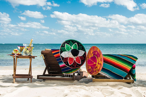 Beach in Mexico, with Beach Chairs and Sombreros
Mexico Bibliography
- Firefly Atlas of North America. Buffalo, NY. Firefly Books. 2006.
Copyright © 2012-2026 Word-Cloud.org. All rights reserved.