
Vermont Word Cloud
Word Cloud > Vermont
Vermont Information
Vermont became the 14th state after the people declared their independence in 1777. Vermont, which means "Green Mountain," is covered by extensive forests. Vermont produces granite and marble, wood furniture, and maple syrup. Tourists find access to lakes, mountain trails, and winter skiing.Authored by jeh. Last updated 2014-11-17 16:53:25.
- Vermont Map
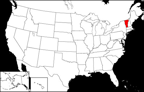
Vermont is the 43rd largest USA state, bordered by the Canadian Province of Quebec, as well as the states of Massachusetts, New Hampshire, and New York. Visit this site to view printable maps of Vermont.
www.state-maps.org/vermont-map/ - Vermont Directory
Learn about Vermont's demographics and economy, and use the Categories Menu to find businesses and other organizations in Vermont.
www.regionaldirectory.us/vermont.htm - Vermont Real Estate Guide
Learn about rural, suburban, and urban real estate markets in Vermont. Real estate agents, buyers, and sellers will appreciate the Vermont real estate resources on this page.
www.local-real-estate.com/vermont.htm - Vermont Atlas
Vermont state history, geography, and travel information are the subjects of this Vermont atlas page.
www.onlineatlas.us/vt.htm  Vermont Road Map (Illustration)
This Vermont map page includes a detailed, scalable road map of Vermont, as well as Interstate highway routes, scenic road information, and transportation department links.
www.state-maps.org/vermont-map/road-map.htm- New England Travel Guide
New England has some popular tourist destinations. To learn about the attractions in each state in the area, read this informative website.
www.new-england-map.com/travel.htm - Massachusetts Map
Massachusetts is the 45th largest state in the USA, bordered by New Hampshire, Connecticut, New York, Rhode Island, Vermont, and the Atlantic Ocean. Several maps of Massachusetts are included on the website.
www.state-maps.org/massachusetts-map/ - New Hampshire Map
New Hampshire is the 44th largest state in the United States. It is bounded to the north by the Canadian Province of Quebec, to the south by Massachusetts, to the west by Vermont, and to the east by Maine.
www.state-maps.org/new-hampshire-map/ - New York Map
New York is the 30th largest state in the USA, bordered by the Canadian Provinces of Quebec and Ontario, and the states of New Jersey, Massachusetts, Vermont, Connecticut, and Pennsylvania.
www.state-maps.org/new-york-map/ - White Church in New England (Digital Image)
A pristine white church is set in front of an azure blue sky. The church's architecture, with its wooden steeple and clapboard siding, is reminiscent of structures in New England.
www.new-england-map.com/search.htm - Pinterest - Vermont Board
This gallery page features selected Vermont images, including the state flag, a locator map, and various travel photos.
www.pinterest.com/onlineatlas/vermont/
Vermont Directory Page(s)
- Vermont Page on AbiReal.com
Visit this vermont category page on abireal.com to find editorially-reviewed resources about this topic.
http://www.abireal.com/info/888/vermont-map.html
- Vermont Page on Adirectory.us
Visit this vermont category page on adirectory.us to find editorially-reviewed resources about this topic.
https://www.adirectory.us/us-states/vermont/
- Vermont Page on GoGuides.org
Visit this vermont category page on goguides.org to find editorially-reviewed resources about this topic.
http://www.goguides.org/topic/1622.html
- Vermont Page on Jumblex.org
Visit this vermont category page on jumblex.org to find editorially-reviewed resources about this topic.
http://en.jumblex.org/vermont/
Vermont News
- Bernie Sanders aims to block sale of bombs and bulldozers to Israel, accusing US ally of 'genocide'
Sen. Bernie Sanders of Vermont is seeking to block the sale of bombs and bulldozers to the foreign nation of Israel, which recently worked with the U.S. to bombard Iran.
Fox News. Tue, 14 Apr 2026 14:09:10 -0400. - Try These Delicious Cheese- And Bread-Making Classes In Beautiful Vermont
Vermont is a food lover's paradise, and you can eat and drink some amazing things and enjoy outdoor adventures while learning to make cheese or bake breads.
By Larry Olmsted, Senior Contributor. Forbes. Thu, 09 Apr 2026 07:15:00 -0400. - Tragedy after woman, 34, struck rough water while kayaking on Vermont river with friend
Sarah Goldberg, of Morrisville, was kayaking with a friend on the Lamoille River Saturday when turbulent waters overturned her boat, causing her to drown.
Daily Mail. Wed, 08 Apr 2026 05:24:41 GMT.
Vermont Image
 Vermont Locator Map
Copyright © 2012-2026 Word-Cloud.org. All rights reserved.