
Iowa Word Cloud
Word Cloud > Iowa
Iowa Information
Prairies covered the land when settlers moved into this Midwest United States area. Rich soil has resulted in a productive farming region which is now called Iowa. Iowa is a top producer of soybeans, corn, hogs, and eggs. Des Moines is the capital of Iowa. Iowa became a state in 1846. The Amana Colonies, a 7-village communal society established about 150 years ago, still draw visitors to enjoy unique food, furniture, art, and crafts.Authored by jeh. Last updated 2015-08-18 07:40:11.
- Iowa Map
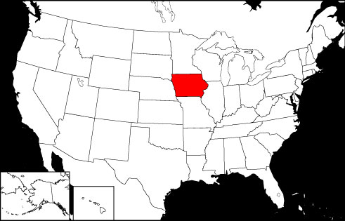
Iowa is the 23rd largest state in the United States, bordered by Minnesota, Missouri, Wisconsin, Illinois, South Dakota, and Nebraska. Visit this site to learn more, and find printable maps of Iowa.
www.state-maps.org/iowa-map/ - Iowa Directory
Learn about Iowa's demographics and economy, and use the Categories Menu to find businesses and other organizations in Iowa.
www.regionaldirectory.us/iowa.htm - Iowa Real Estate Guide
Learn about urban, rural, and suburban real estate markets in Iowa. Real estate agents, buyers, and sellers will appreciate the Iowa real estate resources on this page.
www.local-real-estate.com/iowa.htm - Iowa Atlas
Iowa state history, geography, and travel information are the subjects of this Iowa atlas page.
www.onlineatlas.us/ia.htm  Iowa Road Map (Illustration)
This Iowa map page includes a detailed, scalable road map of Iowa, as well as Interstate highway routes, scenic road information, and state road and transport links.
www.state-maps.org/iowa-map/road-map.htm- Illinois Map
Illinois is the 24th largest state in the USA, bounded by the states of Wisconsin, Indiana, Kentucky, Iowa, and Missouri. Visit this site to learn more about the state, and find printable maps of Illinois.
www.state-maps.org/illinois-map/ - Missouri Map
Missouri is the 18th largest USA state, bordered by Iowa, Arkansas, Kentucky, Kansas, Illinois, Tennessee, Nebraska, and Oklahoma. Visit this site to learn more about Missouri and find printable maps of the state.
www.state-maps.org/missouri-map/ - Nebraska Map
Nebraska is the 15th largest USA state, bordered by South Dakota, Kansas, Iowa, Wyoming, Missouri, and Colorado. Visit this site to learn more about Nebraska and find printable maps of the state.
www.state-maps.org/nebraska-map/ - South Dakota Map
South Dakota is the 16th largest USA state, bordered by North Dakota, Nebraska, Minnesota, Iowa, Montana, and Wyoming. Visit this site to learn more about South Dakota and find printable maps of the state.
www.state-maps.org/south-dakota-map/ - Wisconsin Map
Wisconsin is the 25th largest USA state, bounded by Lake Superior to the north, Illinois to the south, Minnesota and Iowa to the west, and Lake Michigan and the state of Michigan to the east.
www.state-maps.org/wisconsin-map/ - Pinterest - Iowa Board
This gallery page features selected Iowa images, including the state flag, a locator map, and various travel photos.
www.pinterest.com/onlineatlas/iowa/
Iowa Directory Page(s)
- Iowa Page on AbiReal.com
Visit this iowa category page on abireal.com to find editorially-reviewed resources about this topic.
http://www.abireal.com/info/919/iowa-map.html
- Iowa Page on Adirectory.us
Visit this iowa category page on adirectory.us to find editorially-reviewed resources about this topic.
https://www.adirectory.us/us-states/iowa/
- Iowa Page on GoGuides.org
Visit this iowa category page on goguides.org to find editorially-reviewed resources about this topic.
http://www.goguides.org/topic/1596.html
- Iowa Page on Jumblex.org
Visit this iowa category page on jumblex.org to find editorially-reviewed resources about this topic.
http://en.jumblex.org/iowa/
Iowa News
- 76ers coach Nick Nurse steps away from team to attend brother's funeral amid Knicks series: report
76ers coach Nick Nurse was reportedly away from the team Tuesday to attend his brother's funeral in Iowa ahead of Game 2 against the New York Knicks.
Fox News. Tue, 05 May 2026 17:24:33 -0400. - Vance casts ballot in Ohio primaries: 'I have to hide it from the reporters'
Vice President Vance cast his ballot in Ohio primary races on Tuesday morning, before he heads to Iowa for campaign events. The vice president, accompanied by his son, Vivek, voted at St. ...
Max Rego. The Hill. Tue, 05 May 2026 16:39:22 +0000. - Iowa woman died following hernia repair after nurses dismissed painful post-surgery symptoms: lawsuit
Yahoo. 2026-05-04T07:21:16Z.
Iowa Image
 Iowa Locator Map
Copyright © 2012-2026 Word-Cloud.org. All rights reserved.