
Ohio Word Cloud
Word Cloud > Ohio
Ohio Information
Early immigration to Ohio was largely due to its location, with Lake Erie in the north and the Ohio River in the south. Canals and railroads also made it easier to access the Ohio area. The state began producing steel, rubber, machinery, and glass. Manufacturing sprang up in Cleveland, Toledo, and Cincinnati. Columbus is the capital of Ohio.Authored by jeh. Last updated 2015-10-06 07:58:14.
- Ohio Map
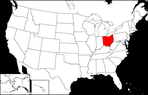
Ohio is the 35th largest state in the USA, bounded by Pennsylvania, Indiana, West Virginia, Michigan, and Kentucky. Visit this site to learn more about the state and view printable maps of Ohio.
www.state-maps.org/ohio-map/ - Ohio Directory
Learn about Ohio's demographics and economy, and use the Categories Menu to find businesses and other organizations in Ohio.
www.regionaldirectory.us/ohio.htm - Ohio Real Estate Guide
Learn about rural, suburban, and urban real estate markets in Ohio. Real estate agents, buyers, and sellers will appreciate the Ohio real estate resources on this page.
www.local-real-estate.com/ohio.htm - Ohio Atlas
Ohio state history, geography, and travel information are the subjects of this Ohio atlas page.
www.onlineatlas.us/oh.htm - Cincinnati, Ohio Skyline (Photograph)
Online photograph, with caption and detailed description, of the Cincinnati, Ohio skyline. Two bridges over the Ohio River are evident in the photo.
www.onlineatlas.us/gallery/cincinnati.htm  Ohio Road Map (Illustration)
Visit this Ohio map page to find a detailed, scalable road map of Ohio, as well as Interstate highway routes, scenic road information, and state transportation links.
www.state-maps.org/ohio-map/road-map.htm- Kentucky Map
Kentucky is the 36th largest state in the United States, and is bordered by Indiana, Tennessee, West Virginia, Missouri, Ohio, Virginia, and Illinois.
www.state-maps.org/kentucky-map/ - Michigan Map
Michigan is the 22nd largest state in the USA, bordered by Lake Michigan, Lake Huron, Lake Superior, Wisconsin, Ohio, Indiana, and the Canadian Province of Ontario.
www.state-maps.org/michigan-map/ - Pennsylvania Map
Pennsylvania is the 32nd largest state in the USA, bordered by New York, Maryland, New Jersey, Ohio, Delaware, West Virginia, and Lake Erie. Visit this site to view printable road maps of Pennsylvania.
www.state-maps.org/pennsylvania-map/ - West Virginia Map
West Virginia is the 41st largest USA state, surrounded by Pennsylvania, Maryland, Virginia, Ohio, and Kentucky. Visit this site to learn more and find printable road, topo, and relief maps of West Virginia.
www.state-maps.org/west-virginia-map/ - Pinterest - Ohio Board
This gallery page features selected Ohio images, including the state flag, a locator map, and various travel photos.
www.pinterest.com/onlineatlas/ohio/
Ohio Directory Page(s)
- Ohio Page on AbiReal.com
Visit this ohio category page on abireal.com to find editorially-reviewed resources about this topic.
http://www.abireal.com/info/913/ohio-map.html
- Ohio Page on Adirectory.us
Visit this ohio category page on adirectory.us to find editorially-reviewed resources about this topic.
https://www.adirectory.us/us-states/ohio/
- Ohio Page on GoGuides.org
Visit this ohio category page on goguides.org to find editorially-reviewed resources about this topic.
http://www.goguides.org/topic/1612.html
- Ohio Page on Jumblex.org
Visit this ohio category page on jumblex.org to find editorially-reviewed resources about this topic.
http://en.jumblex.org/ohio/
Ohio News
- Whirlpool Expands U.S. Footprint With $60M Investment in Ohio Plant
WHR plans a $60M Ohio plant and broader $300M U.S. expansion, boosting capacity, jobs and innovation push amid ongoing market pressures.
Zacks Equity Research. Zacks. Mon, 13 Apr 2026 17:22:00 GMT. - Financial advice influencer sentenced in Ohio federal court to six years in prison for wire fraud
A financial advice influencer was sentenced in an Ohio federal court Friday to six years in prison for wire fraud and aiding in a false tax filing.
Brad Matthews. Washington Times. Sat, 11 Apr 2026 17:37:16 -0400. - Ohio State football coach Ryan Day responds to viral 'nipple ring' fiasco: 'I thought it gave me street cred'
Barstool Sports podcaster Dan Katz shared a screen grab of Ryan Day's on-field interview, allowing followers to see the phony impression of a nipple ring poking through the coach's shirt.
Daily Mail. Sat, 11 Apr 2026 12:40:16 GMT. - Ohio teacher sues high school for demanding he remove LGBT poster inside classroom
An anonymous Ohio high school teacher is suing the Little Miami School District over the removal of an LGBTQ poster that hung in his classroom for years.
Fox News. Fri, 10 Apr 2026 17:00:30 -0400. - Cal's Pippen back to B1G, commits to Ohio State
Cal sophomore guard Justin Pippen, who spent his freshman year at Michigan before heading to Berkley, is transferring to Ohio State, his agents at WME Basketball told ESPN.
Pete Thamel. ESPN. Fri, 10 Apr 2026 13:27:59 EST.
Ohio Image
 Ohio Locator Map
Copyright © 2012-2026 Word-Cloud.org. All rights reserved.