
Kansas Word Cloud
Word Cloud > Kansas
Kansas Information
Kansas entered the union as a free state in 1861. It was, at one time, considered unsuitable for settlement with tall prairie grass. It is now the leading producer of wheat in the United States. Kansas also remains a leading beef producer. Dodge City was the railroad center for Texas cattle drives in wild west days. Topeka is the capital of Kansas, and Wichita is the largest city.Authored by jeh. Last updated 2015-10-06 06:56:41.
- Kansas Map
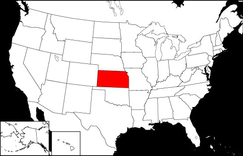
Kansas is the 13th largest state in the United States, and is bordered by Nebraska, Oklahoma, Missouri, and Colorado. Visit this site to learn more about Kansas, and find printable maps of the state.
www.kansas-map.org/ - Kansas Directory
Learn about Kansas' demographics and economy, and use the Categories Menu to find businesses and other organizations in Kansas.
www.regionaldirectory.us/kansas.htm - Kansas Real Estate Guide
Learn about urban, suburban, and rural real estate markets in Kansas. Real estate agents, buyers, and sellers will appreciate the Kansas real estate resources on this page.
www.local-real-estate.com/kansas.htm - Kansas Atlas
Kansas state history, geography, and travel information are the subjects of this Kansas atlas page.
www.onlineatlas.us/ks.htm  Kansas Road Map (Illustration)
This Kansas map page features a detailed, scalable road map of Kansas, as well as Interstate highway routings, scenic byway highlights, and state transportation links.
www.kansas-map.org/road-map.htm- Kansas City, Missouri (Photograph)
Captioned online picture and description of the Kansas City, Missouri skyline, with a storm cloud overhead.
www.onlineatlas.us/gallery/kansas-city.htm - Colorado Map
Colorado is the 8th largest USA state, bordered to the north by Wyoming, the south by New Mexico, Utah to the west, and Kansas to the east. Visit this site to learn more about the state of Colorado.
www.colorado-map.org/ - Missouri Map
Missouri is the 18th largest USA state, bordered by Iowa, Arkansas, Kentucky, Kansas, Illinois, Tennessee, Nebraska, and Oklahoma. Visit this site to learn more about Missouri and find printable maps of the state.
www.missouri-map.org/ - Nebraska Map
Nebraska is the 15th largest USA state, bordered by South Dakota, Kansas, Iowa, Wyoming, Missouri, and Colorado. Visit this site to learn more about Nebraska and find printable maps of the state.
www.nebraska-map.org/ - Oklahoma Map
Oklahoma is the 19th largest state in the USA, bounded by Kansas, Texas, Arkansas, New Mexico, Missouri, and Colorado. Visit this site to learn more about the State of Oklahoma and find printable maps of Oklahoma.
www.oklahoma-map.org/ - Pinterest - Kansas Board
This gallery page features selected Kansas images, including the state flag, a locator map, and various travel photos.
www.pinterest.com/onlineatlas/kansas/
Kansas Directory Page(s)
- Kansas Page on AbiReal.com
Visit this kansas category page on abireal.com to find editorially-reviewed resources about this topic.
http://www.abireal.com/info/918/kansas-map.html
- Kansas Page on Adirectory.us
Visit this kansas category page on adirectory.us to find editorially-reviewed resources about this topic.
https://www.adirectory.us/us-states/kansas/
- Kansas Page on GoGuides.org
Visit this kansas category page on goguides.org to find editorially-reviewed resources about this topic.
http://www.goguides.org/topic/1597.html
- Kansas Page on Jumblex.org
Visit this kansas category page on jumblex.org to find editorially-reviewed resources about this topic.
http://en.jumblex.org/kansas/
Kansas News
- Kansas City Chiefs fans deaths: Autopsy reports complete, suppressed by ongoing death investigation
Autopsies are complete for deceased Kansas City Chiefs fans Ricky Johnson, David Harrington and Clayton McGeeney - those results have been suppressed until an investigation is complete.
Fox News. Thu, 25 Apr 2024 12:18:04 -0400. - 5th person charged in killing of 2 Kansas moms, officials say
Paul Grice, 31, was arrested and charged by Oklahoma authorities with murder and kidnapping in connection to the deaths of Veronica Butler and Jilian Kelley.
CBS News. Wed, 24 Apr 2024 18:56:21 -0400. - Pitching, defense and a budding star: Why the red-hot Royals might actually be for real
Kansas City has had a surprising and enjoyable run to open the season. Now, the question is whether it's going to be a long run.
Bradford Doolittle. ESPN. Wed, 24 Apr 2024 12:20:48 EST. - Canadian Pacific Kansas City (CP) Q1 Earnings Miss Estimates
Canadian Pacific Kansas City (CP) delivered earnings and revenue surprises of -1.43% and 0.84%, respectively, for the quarter ended March 2024. Do the numbers hold clues to what lies ahead for the stock?
Zacks Equity Research. Zacks. Wed, 24 Apr 2024 14:15:02 GMT. - Karen the ostrich known as Kansas zoo's 'dancing queen' dies after grabbing and swallowing staff member's keys
Karen, a five-year-old ostrich at the Topeka Zoo & Conservation Center in Kansas 'passed away in staff's hands' after they were unable to operate and retrieve the keys.
Daily Mail. Tue, 23 Apr 2024 18:51:49 +0100.
Kansas Image
 Kansas Locator Map
Copyright © 2012-2024 Word-Cloud.org. All rights reserved.