
Indiana Word Cloud
Word Cloud > Indiana
Indiana Information
The state of Indiana is located in the Midwest United States. Indian tribes were settled in the region long before Europeans arrived in the early 1700s. Thus the state's name means "Land of the Indians." Indiana became a state in 1816. Its capital city, Indianapolis, is called the Crossroads of America because highways converge from all directions. Hogs, corn, and soybeans are important products. Indiana also borders Lake Michigan, which brings recreational and economic advantages to the state.Authored by jeh. Last updated 2015-08-18 08:22:28.
- Indiana Map
Indiana is the 38th largest state in the USA, bounded by the states of Kentucky, Ohio, Illinois, and Michigan. Visit this site to learn more about Indiana, and view printable maps of Indiana.
www.indiana-map.org/ - Indiana Directory
Learn about Indiana's demographics and economy, and use the Categories Menu to find businesses and other organizations in Indiana.
www.regionaldirectory.us/indiana.htm - Indiana Real Estate Guide
Learn about rural, suburban, and urban real estate markets in Indiana. Real estate agents, buyers, and sellers will appreciate the Indiana real estate resources on this page.
www.local-real-estate.com/indiana.htm - Indiana Atlas
Indiana state history, geography, and travel information are the subjects of this Indiana atlas page.
www.onlineatlas.us/in.htm  Indiana Road Map (Illustration)
This Indiana map page comprises a detailed, scalable road map of Indiana plus Interstate highway information, scenic road highlights, and state transportation links.
www.indiana-map.org/road-map.htm- Kentucky Map
Kentucky is the 36th largest state in the United States, and is bordered by Indiana, Tennessee, West Virginia, Missouri, Ohio, Virginia, and Illinois.
www.kentucky-map.org/ - Michigan Map
Michigan is the 22nd largest state in the USA, bordered by Lake Michigan, Lake Huron, Lake Superior, Wisconsin, Ohio, Indiana, and the Canadian Province of Ontario.
www.michigan-map.org/ - Ohio Map
Ohio is the 35th largest state in the USA, bounded by Pennsylvania, Indiana, West Virginia, Michigan, and Kentucky. Visit this site to learn more about the state and view printable maps of Ohio.
www.ohio-map.org/ - Pinterest - Indiana Board
This gallery page features selected Indiana images, including the state flag, a locator map, and various travel photos.
www.pinterest.com/onlineatlas/indiana/
Indiana Directory Page(s)
- Indiana Map Page on AbiReal.com
Visit this indiana map category page on abireal.com to find editorially-reviewed resources about this topic.
http://www.abireal.com/info/882/indiana-map.html
- Indiana Page on Adirectory.us
Visit this indiana category page on adirectory.us to find editorially-reviewed resources about this topic.
https://www.adirectory.us/us-states/indiana/
- Indiana Page on GoGuides.org
Visit this indiana category page on goguides.org to find editorially-reviewed resources about this topic.
http://www.goguides.org/topic/1595.html
- Indiana Page on Jumblex.org
Visit this indiana category page on jumblex.org to find editorially-reviewed resources about this topic.
http://en.jumblex.org/indiana/
Indiana News
- Man indicted in cold case killing of retired Indiana farmer
William Ray Grimes was indicted on charges of murder and burglary in the 2012 slaying of Lowell Badger, police said.
CBS News. Thu, 25 Apr 2024 06:35:00 -0400. - 6 Republican candidates for governor of Indiana to debate ahead of primary
Six Republican candidates for governor of Indiana will participate in a debate on April 23, 2024. Current Gov. Eric Holcomb, who has reached his term limit, has not made an endorsement.
Fox News. Tue, 23 Apr 2024 08:51:46 -0400. - Indiana St. star Avila follows coach to Saint Louis
Former Indiana State star Robbie Avila, one of the biggest breakout players last season, is following Josh Schertz and transferring to Saint Louis.
Jeff Borzello. ESPN. Sat, 20 Apr 2024 18:50:47 EST. - GOP congressman introduces bill to defund taxpayer-backed NPR
Indiana Republican Rep. Jim Banks has introduced a bill aimed at withdrawing federal funding from National Public Radio.
Staff. Washington Times. Fri, 19 Apr 2024 13:20:36 -0400.
Indiana Image
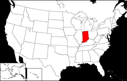 Indiana Locator Map
Copyright © 2012-2024 Word-Cloud.org. All rights reserved.